Thursday, January 31, 2008

Elevations & Sections

I've developed my elevations by constructing a 3D model. On the Boylston Street facade, which contains the exhibit Hall, the Internet Cafe' and the Multi-Media Area, I utilized a storefront system to allow maximum visibility for pedestrian traffic.

Outdoor green spaces include a street-level garden area which will be accessible to the public. It is on the small triangular portion of the property closest to the intersection of Mass Ave and Boylston. There is also a Roof Garden above, and only accessible to patrons of the Internet Cafe'. Finally, there are two Roof Gardens above and accessible to the Classroom/Studio occupants.


I've incorporated exterior light shelves which are designed to bring southern winter daylight into the building while blocking harsh glare from the summer sun.


This cross-section is through the Classrooms on the third and fourth floors, and the Multi-Media Area and Internet' Cafe' on the ground floor. This section also shows the Loding Dock to the bottom left and service areas. The 'fins' used to direct daylight are also articulated in this drawing.

This drawing illustrates sections through the Multi-Media Area and the Exhibit Hall on the ground floor and the Dorm Rooms on the third and fourth floors. This also shows the fenestration on the Boylston Street facade.

Friday, January 25, 2008

Revised Floor Plans

I have included the lower floor plan (below grade) and made some modifications to the layout based on feedback at the intensive.

On the Lower Floor Plan I've included Parking, Delivery and other service functions. I tried to stack services vertically the are required throughout the building, such as, the Mechanical Room, Public Restrooms, and the Service Kitchen which includes a dumbwaiter.


On the First Floor I relocated the Exhibit Hall to be more accessible to the public. It is a double height space, as is the Multi-Media/Conference Area. I've also included an Internet Cafe' to help attract neighborhood pedestrian traffic to the building. This could create the opportunity for the neighborhood to learn more about sustainablity.

The Second Floor still houses the same functions but I've relocated the IT Resources, Model Shop, and Print/Copy/Scanning Rooms to the Nrthwest portion of the building. The Cafeteria now has a visual connection to the Exhibit Hall on the the First Floor below (a Food Prep Area is directly across the corridor from the Cafeteria). The Multi-Media/Conference Area contains a Mexxanine on this floor. And there is a Roof Garden accessible only from the Internet Cafe'.

The Third and Fourth Floors remain the same except for a Mechanical Room adjacent to the Exit Stair.


I am in the process of generating a 3D model. I will post this along with the sections and elevations this weekend.

Tuesday, January 22, 2008

Final Intensive Critique

Client Requirements
The client requesting us to provide a facility that houses the intensive portion of a distance learning program. It will be located within the vicinity of the Boston Architectural College to allow for easy access for support functions (such as Library, IT, etc). The new facility will offer Living Quarters for 24 students, 3 Classrooms/Studios for up to 14 students each, and Dining/Lounge/Exhibit Area. The facility will be open 24 hours each day, with scanning, printing and model making available onsite. Desk work, lectures and critiques will happen Classrooms and the Lounge Areas. The Exhibit space shall be open at times to larger community. A Break Room will offer snacks and beverages. Sandwiches will be catered (other meals will have to take place offsite). It is desired to have a small outdoor space for recreational or contemplative use on the site.

Key Concept
Teach by Doing

Core Objectives
Community
Relationship Building with the broader community
Site design is inviting to and embraces the surrounding community

Sustainability
Introduce sustainable features
Illustrate client commitment to the environment and the larger community

Education
The client is committed to education grounded in practice. The design response is to educate about sustainable strategies by incorporating working examples of sustainable solutions. The building program offers an opportunity to bring sustainable technologies to the forefront, which will open a dialog for educating the community about these technologies.


The site plan shows the orientation of the building with a long axis along I-90, and portions of the building located along Boylston Street. There will be a couple of outdoor green spaces planned to invite pedestrians into the site.


The first floor is at ground level. The main spaces on this floor are theExhibit Hall and the Multi-Medi/Conference Area. Public spaces such as the Main Entry/ Security Areas, Restrooms, and vertical circulation are also located on this floor. Finally, faculty office relating to the distance program are located on this floor.


Along with service functions that are located on both the first and second floors, there are support spaces for the distance program. These include the Cafeteria, the Model Shop, IT Resources, Print/Scanning/Copy Area, and LAN Room.


The Third and Fourth Floors house the funtions for the distance program. The Doorm rooms are on the south facade and the Classrooms are on the north facade along the I-90 Turnpike.

Thursday, January 17, 2008

First Massing Model


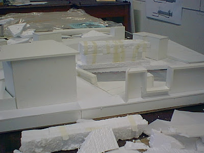
Second Massing Model


Friday, January 11, 2008

Assignment 3 - Distance Learning Center Program

Our client has requesting a facility to house the intensive portion of a distance learning program. It will be located within walking distance of the Boston Architectural College. Support functions such as Library, IT, etc. will remain in the main facility at 320 Newbury. The new facility should be design so that students traveling to Boston can direct most of their time and energy toward coursework. The intensive period is vital in the development of each student’s required work for the semester. It is the one time they can interact face-to-face with their professors and cohorts. It is equally important that students have areas to retreat and reflect on ideas, concepts and partis. The building will be design with an emphasis on sustainability, at the clients request. This will not only help environmentally, but will also be a vital learning tool for the students using the building.

The Spreadsheet below illustrates space requirements and sustainable strategies.

The Exhibit Hall, Classrooms, Dining and Recreation Areas will be open to provide for multiple activities that may occur in these spaces. The HVAC, water supply, and lighting will all incorporate sustainable features. A central atrium space may be one option for bringing daylight into the building.

Dorm Rooms are required to have a higher level of privacy, so that students can rejuvenate without interruption.

There will also be some outdoor spaces that will allow for areas of contemplation when the weather permits.

Parking requirements will be minimal because students will be traveling from long distances and typically do not have an automobile. This will also allow for minimal impact on the site.


The Bubble Diagram shows relationships.

Thursday, January 10, 2008

Assignment 2 – Genzyme Center

Site Context:

The Genzyme Center is located in the Kendall Square area of Cambridge, MA. In the past the area has been predominately industrial – factories, utility operations and parking lots. In recent years the area has undergone significant change and will evolve into a cultural, recreational and retail hub. The site is just to the east of the MIT campus and north of the Charles River. Its former use was a coal gasification plant. To prepare the site for reuse in underwent Brownfield remediation.


Views out of the building to adjacent features.

Program Area:

The design proposal strongly emphasized a design that grew from the work environment out. This concept allowed the opportunity to break up the building volume into smaller volumes. Designers could then introduce areas of interior light an terraced interior openings. The “green” concepts worked hand in hand with the initial design intent.

Bubble Diagram


Ground Floor Plan/Views:

Views into the building.

Section/Elevation:

The building functions are centered around a central atrium. Daylight is allowed to flood the building and is directed into the Atrium through a prismatic skylight by the Heliostate.

Daylight from the exterior is directed to reflective ceiling panels which carry the light into the core of the building.

This Diagram illustrates how a stack ventilation configuration.


This elevation shows how the “Inside-Out” concept breaks up the exterior façade – Interior functions influence the exterior skin.

Wednesday, January 9, 2008

A Couple More Maps

This map shows the Neighborhoods and includes the 2000 Census Blocks.


A 2003 from the Boston Assessment Office illustrating ownership as of January 2002.

Somewhere In Time . . .

I just wanted to add a couple more maps show the progress of the area over time (approximately 150 years).
This is a 1851 map of the area showing the general location of our site.


A map from 1954. This illustrates a grid pattern for streets, but notice the absense of the turnpike.


By 2003 the turnpike has been constructed and land development has increased significantly.


Locations of other institutions of higher learning in the Boston Area.

Sunday, January 6, 2008

Assignment 1 - People and History

History:
From the 2000 Census of Population and Housing

The Fenway and Kenmore area is the result of the annexation of a parcel of land from the neighboring town of Brookline in the 1870s, and from landfill and creation of a combination park/drainage/sewerage project by landscape architect Frederick Law Olmsted in the 1890s.

Originally called Governor's Square, today's Kenmore Square became a commercial center with the extension of the Boylston Street subway in 1914 and received its current name in 1932. Over the years, it became home to a number of hotels and residential apartment buildings, many of them turned into dormitories today.

At the turn of the last century, the former marshland of the Fens area began attracting Boston's leading religious, cultural, and health care, looking to expand their facilities. The Christian Science Church came first, dedicating its "mother church" in 1894. Boston Symphony Hall (1900), Isabella Stewart Gardner's Fenway Court (1903), and Museum of Fine Arts (1909) came soon after. The Longwood Medical area began to form when Harvard Medical School (1904), Peter Bent Brigham Hospital (1913), Children's Hospital (1914), and the Boston Lying-In Hospital (1923) opened their doors in later years.

Today, Kenmore Square and Boylston Street through the Fenway are the commercial centers. The Charlesgate area and the Back Bay Fens provide open space.

Beacon Hill was the site of the home of the first European settler of Boston, the Rev. William Blackstone, who welcomed John Winthrop and the Puritans when they arrived in 1630. Originally a much taller, three-peaked hill, it was reduced in height over time and transformed into a residential area. Early in its history, the south slope along Boston Common became Boston's most prestigious address, and the North Slope home to Boston's early African-American community.

The Back Bay was originally a tidal bay, crossed first by the Mill Dam in 1821, then 15 years later by railroad trestles, and finally filled by trainloads of gravel brought from a quarry in Needham beginning in 1858. The residential neighborhood created was designed in the "French style," with long, wide boulevards and shorter, narrower cross streets.

Today, both Beacon Hill and the Back Bay neighborhoods are preserved as historic districts. Charles Street serves as Beacon Hill's main commercial area. Boylston and Newbury Streets serve as the "main streets" not only of the Back Bay but also of all downtown Boston. Both neighborhoods are served by some of Boston's prime open spaces - Boston Common (established in 1634 and the oldest public park in America), the Public Garden (est. 1837), and the Esplanade along the Charles River (created in the 1930s).

People:
The Back Bay – Beacon Hill Neighborhoods, the South End, Jamaica Plain and Roxbury are adjacent to the Fenway – Kenmore Neighborhood. The people of these neighborhoods have a major impact on each other. And residents of the Fenway-Kenmore neighborhood are mainly college students or single professionals. The Back Bay neighborhood is mainly single or married professionals with no children. The majority of residents of the Beacon Hill neighborhood are older established professional families. While the residents of Jamaica Plain, the South End, and Roxbury, who are in occupations that support the first Back Bay-Beacon Hill neighborhoods, are mainly non-professional single or married couples with families.

Building Functions:
To the northeast, across the Massachusetts Turnpike, the Back Bay and Beacon Hill neighborhoods is an older, more established mixed-used (residential/retail & office) neighborhood.

At present, our site is zoned H-3 – Apartments and B-2 – Retail Business & Office. Therefore, our site may require rezoning. Historically, the neighborhood has included multi-family dwellings that have since been converted to dormitories. It is also home to a thriving residential community; large number Boston's academic institutions, including Emmanuel, Simmons, and Wheelock Colleges, Boston and Northeastern Universities, and Wentworth Institute of Technology. The proximity to other area land uses makes this site great location for our proposed use.

Getting into the Area:
Historically, people in the neighborhood traveled on foot. The increase in population in the area and a desire to offer low cost transportation for those in service occupations from the surrounding neighborhoods brought about the need for public transportation. The public transportation system is the Massachusetts Bay Transportation Authority (MBTA). It connects the Fenway-Kenmore neighborhood with the Back Bay, the South End and Allston-Brighton. The MBTA Subway system has lines and stops in the vicinity to allow people to enter the area by rail. However, people arrive mainly by automobile. Once in the area a significant amount of people travel on foot.